These 10 Bucket-List Hikes Across America Are Worth Building a Trip Around

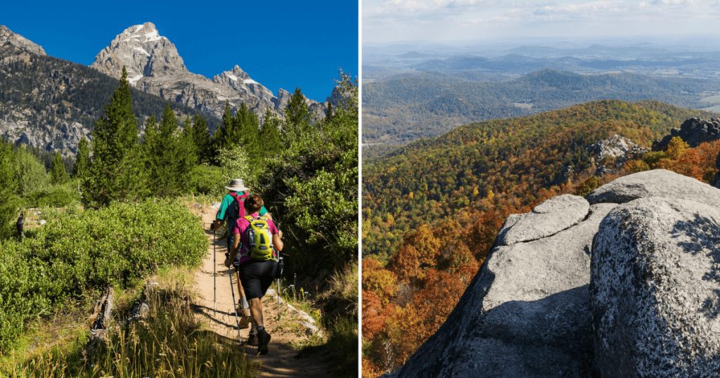
I once spent an entire winter convinced I wasn’t really a “hiker,” more of a person who occasionally walked uphill near nice scenery and called it exercise. Then I started researching the trails serious hikers actually dream about, and that tidy little self-image fell apart fast.
Turns out you don’t need to identify as an athlete to chase a bucket-list trail. You just need the right pair of boots, a healthy respect for permits, and a willingness to start before sunrise more often than feels reasonable to most people.
Here are ten hikes scattered across ten different states, each one earning its spot on serious hiking lists again and again, for reasons that go well beyond a pretty photo at the summit.
A few of these require nothing more than sturdy boots and an early alarm. Others demand a permit, a lottery win, and a genuine tolerance for heights. Either way, every single one of them has a story worth knowing before you go.
1. Angels Landing, Utah
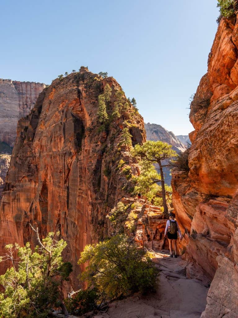
Angels Landing is a thin fin of Navajo sandstone jutting straight into Zion Canyon, ending in a narrow knife-edge ridge with chains bolted into the rock and drop-offs exceeding 1,000 feet on either side. The name itself implies that only angels could safely land there at all.
The roughly 5.4-mile round trip climbs nearly 1,500 feet, including 21 tight switchbacks called Walter’s Wiggles, engineered directly into the cliff face. Reaching Scout Lookout requires no permit, but the final, permitted half-mile along the chains is the part everyone talks about.
That permit system only began in 2022, after growing crowds turned the narrow ridge into a genuinely dangerous bottleneck. Permits are required 24 hours a day, year-round, just to step past Scout Lookout, checked by rangers stationed right at that exact boundary point.
Zion now issues more than 200,000 of these permits every single year, split between a seasonal lottery for trip planners and a day-before lottery for the more spontaneous. Either way, the half-mile beyond the lookout remains the single most talked-about stretch of trail in the entire park.
Where: 1 Zion Park Blvd, Springdale, UT 84767
2. Grand Canyon Rim to Rim, Arizona
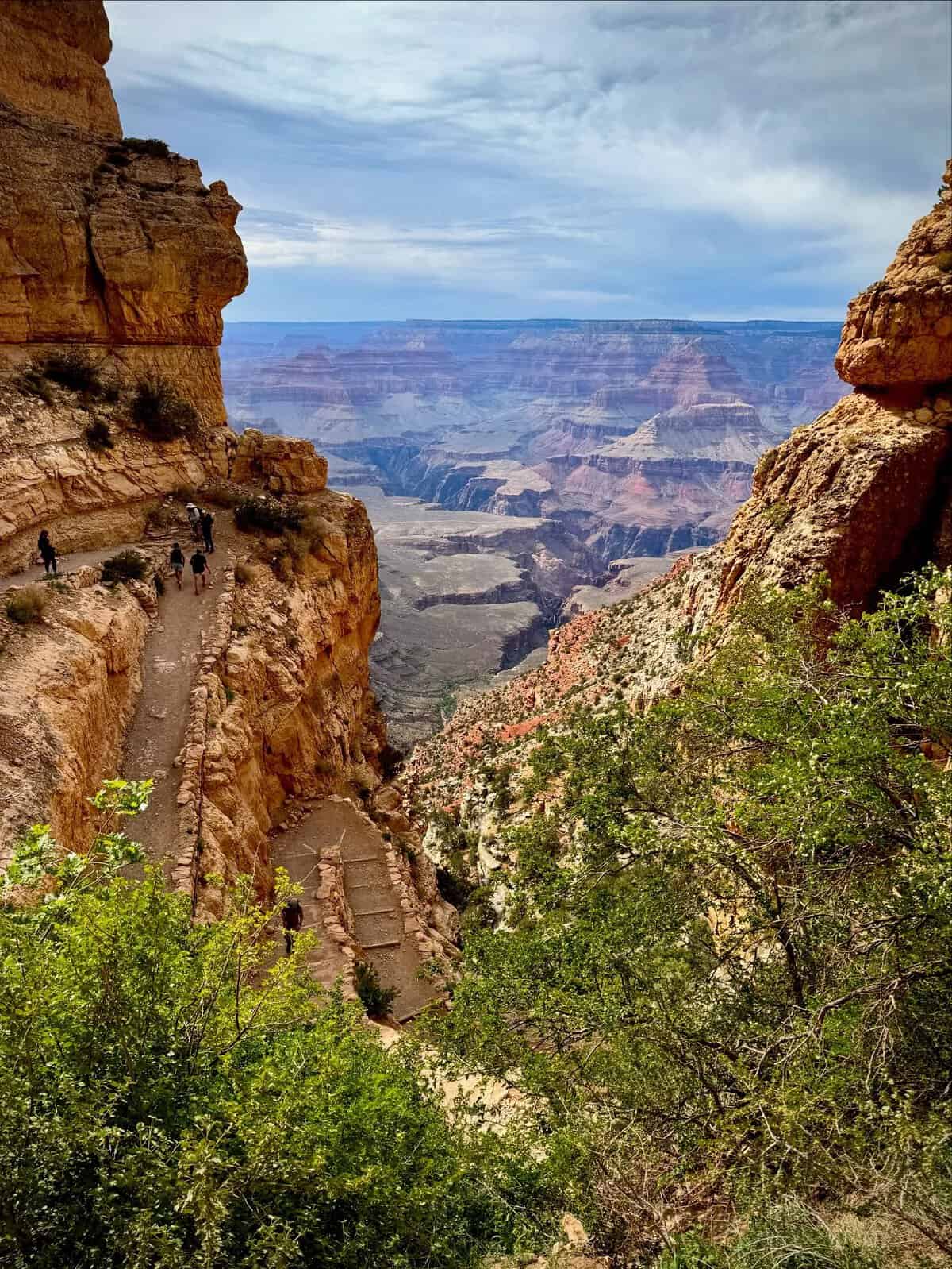
Hiking the Grand Canyon from the South Rim to the North Rim covers roughly 21 miles one-way, dropping a full mile in elevation before climbing back out the other side. Most hikers split it across two or more days, though some attempt the round trip in one push.
Nothing quite prepares you for the scale of it. Standing at the canyon’s bottom looking straight up at both distant rims gives a visceral sense of depth that no overlook photo ever fully captures, no matter how many you’ve scrolled past online beforehand.
The North Rim closes seasonally each winter, narrowing the calendar window considerably for most visitors. Shuttle services exist to move hikers and gear between rims, sparing you the need to backtrack the same brutal elevation change twice in one trip.
Some especially fit hikers attempt the full round trip in a single day, a feat known among regulars simply as “rim to rim to rim.” It demands a cumulative elevation change well over 20,000 feet and a level of preparation most casual visitors never quite anticipate.
Where: Grand Canyon Village, AZ 86023
3. Half Dome, California
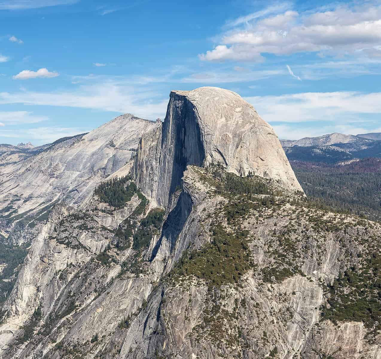
Half Dome rises 8,839 feet above Yosemite Valley, its sheer granite face instantly recognizable from countless photographs and postcards sold throughout the park. The final 400 feet to the summit require pulling yourself up steel cables bolted into the rock at a startlingly steep angle.
Most hikers tackle the steeper Mist Trail first, passing 317-foot Vernal Fall and 594-foot Nevada Fall before reaching the cables leading toward the summit. At the very top, many venture out onto The Visor, a granite overhang above Half Dome’s famous northwest face, for the inevitable photo.
A wilderness permit lottery controls cable access during peak season, since the narrow route simply can’t handle unlimited daily traffic safely. Starting an hour before sunrise remains the best strategy for beating both the crowds and the worst of the midday sun.
Afternoon thunderstorms are a genuine hazard up here too, since the cables sit fully exposed on bare granite with nothing nearby to offer shelter. Rangers regularly turn hikers back once lightning risk rises, regardless of how close to the top someone might already be.
Where: Yosemite Valley, Yosemite National Park, CA 95389
4. The Highline Trail, Montana
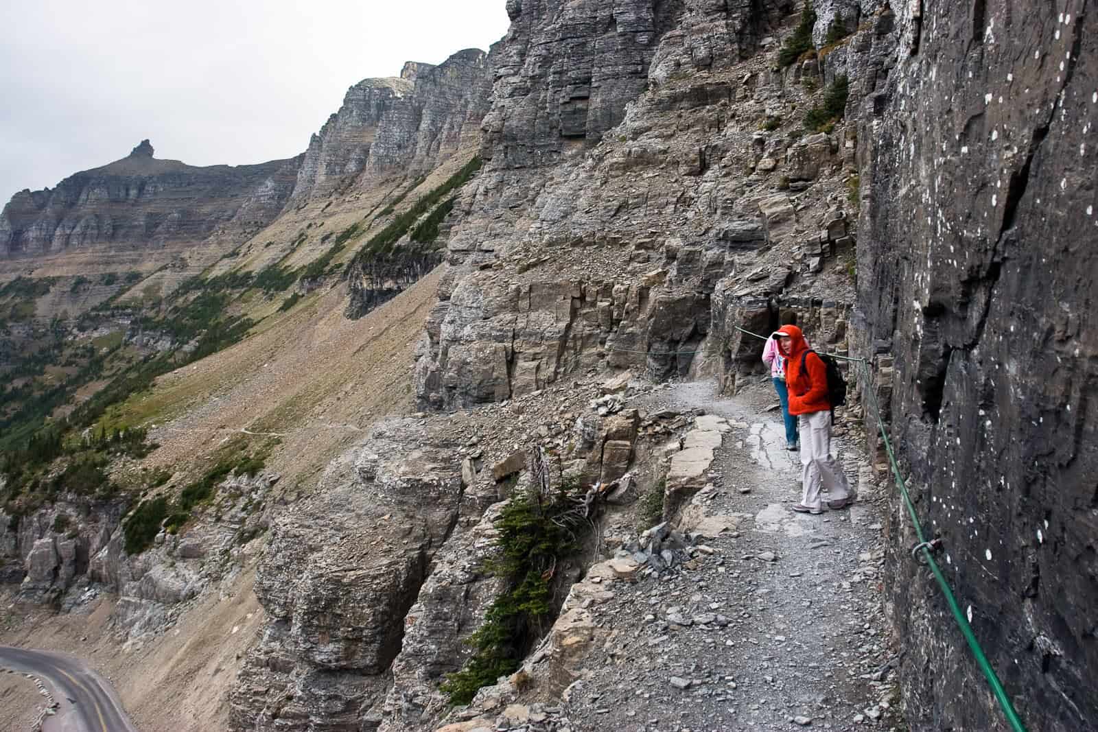
Glacier National Park’s Highline Trail begins at 6,646-foot Logan Pass, the highest point reachable along the famous Going-to-the-Sun Road, then traverses north across rolling alpine terrain well above treeline for miles in a continuous stretch.
Bighorn sheep and mountain goats turn up regularly along the route, and hikers occasionally spot black bears or even grizzlies in the distance, making early starts and a pair of binoculars genuinely worthwhile rather than optional extras for the whole trip.
Distance options range from a short out-and-back near Logan Pass to a full 11.8-mile trek ending at The Loop on Going-to-the-Sun Road, itself a stop on the park’s free shuttle. Either version delivers uninterrupted views of jagged peaks the entire way.
Park rangers generally recommend starting in the morning rather than the evening, both for better wildlife-spotting odds and as a basic safety precaution, since bears tend to be more active once the day’s heat begins to fade toward dusk.
Where: Logan Pass, Glacier National Park, MT 59936
5. The Teton Crest Trail, Wyoming
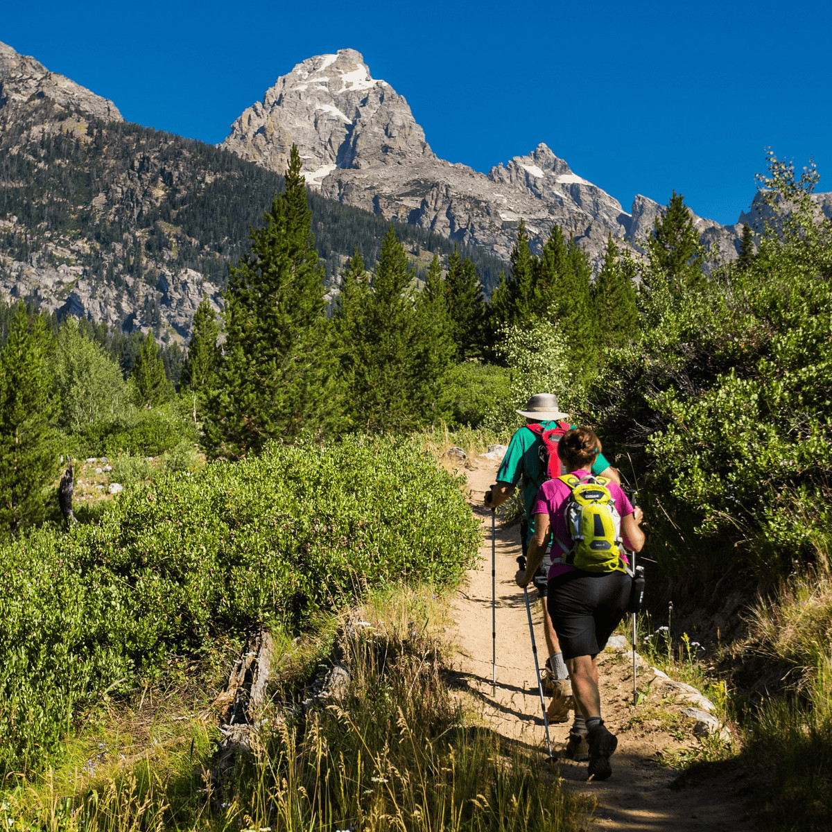
Running north-south through the heart of Grand Teton National Park, the Teton Crest Trail stays above treeline for much of its considerable length, threading through Cascade Canyon, Paintbrush Canyon, and the upper forks of Granite Canyon along the way.
Lake Solitude, tucked into the North Fork of Cascade Canyon, ranks among the route’s most photographed stops, a glacial lake framed by jagged peaks that somehow look even sharper in person than any wide-angle lens could ever suggest.
The trail crosses Paintbrush Divide at 10,720 feet, the high point of the route, before descending toward the South Fork of Cascade Canyon. Various access trails allow hikers to customize the distance, making it one of the West’s most flexible premier treks.
Backpackers usually spend several nights covering the full traverse, though strong dayhikers sometimes sample just the most scenic middle section instead. Either approach delivers the same dramatic skyline that first drew climbers and photographers to these mountains many generations ago, long before the park itself even existed.
Where: Grand Teton National Park, Moose, WY 83012
6. Mount LeConte via Alum Cave Trail, Tennessee
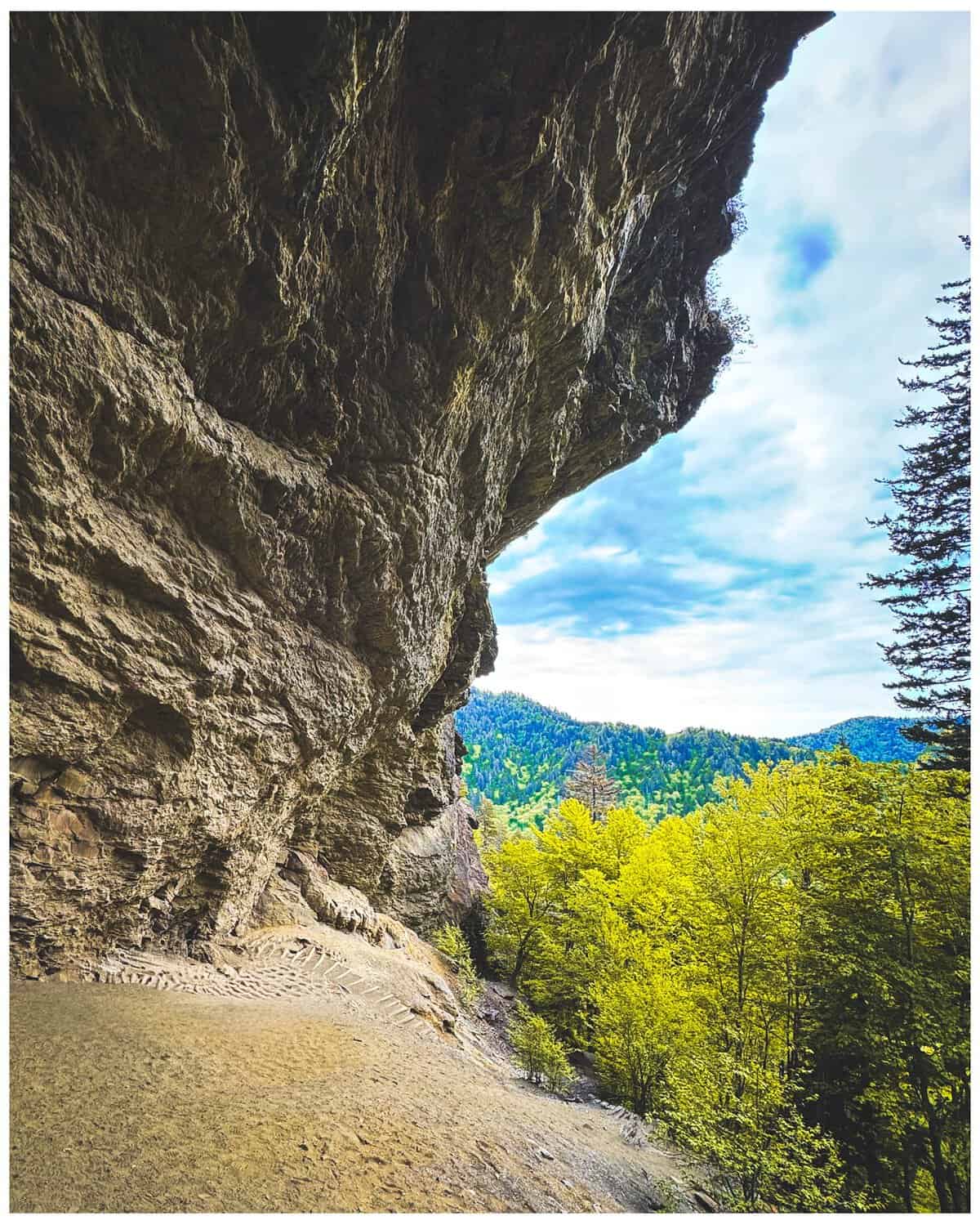
Mount LeConte stands as the third-highest peak in the Great Smoky Mountains at 6,593 feet, and the Alum Cave Trail remains the shortest and most popular of six different routes leading to its summit, climbing 2,763 feet over a span of 5.5 miles.
Along the way, hikers pass Arch Rock, a natural stone arch carved by centuries of freezing and thawing, then Alum Cave Bluffs, a massive overhanging cliff named for mineral deposits discovered there in the 1800s, before reaching Inspiration Point’s sweeping views.
The mountain itself is named for geologist Joseph Le Conte, a co-founder of the Sierra Club alongside John Muir, though some locals insist credit really belongs to his brother John, who helped survey and measure the peak’s true elevation decades earlier.
Near the summit sits LeConte Lodge, which began as a 1925 tent camp built by hiker Paul Adams to showcase the Smokies to visiting dignitaries from Washington. That lodge, predating the national park itself, helped build the case for protecting these mountains at all.
Today, it remains the highest guest lodge in the eastern United States, supplied by llama trains that haul food and linens up the mountain several times a week. Day hikers can still stop in for water or a quick snack before continuing on to the actual summit.
Where: 3639 Newfound Gap Rd, Gatlinburg, TN 37738
7. Old Rag, Virginia
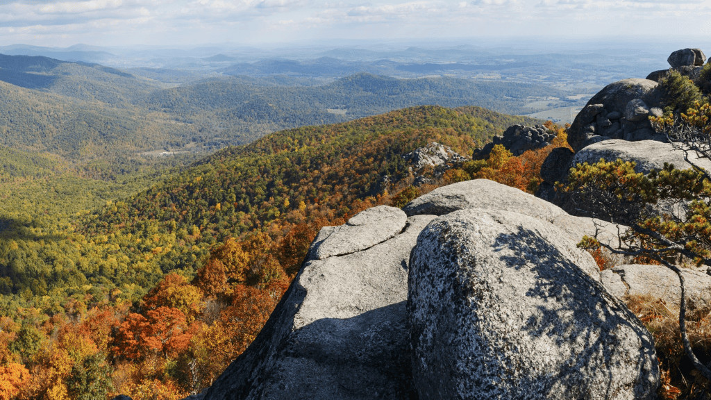
Old Rag rises 3,284 feet within Shenandoah National Park, underlain by distinctive granite that formed roughly a billion years ago during an ancient mountain-building event geologists call the Grenville Orogeny, long before the Blue Ridge Mountains themselves ever existed.
The roughly 9-mile loop trail is famous for its nearly mile-long rock scramble, a stretch requiring hands, knees, and genuine upper-body strength to navigate, squeezing through tight granite crevices and pulling yourself up exposed boulder faces along narrow ridgelines.
Since 2022, the park has required day-use tickets for Old Rag between March and November each year, capping visitors at 800 per day to ease overcrowding that once left hikers waiting in line mid-scramble. Several false summits test patience well before the real one ever appears.
The granite itself offers genuine rock-climbing terrain too, with splitter cracks and slabs that draw climbers, comparing it favorably to spots out west like the Sierra Nevada. Most hikers, though, are simply there for the boulders, the panoramic views, and the bragging rights that come afterward.
Where: Old Rag Mountain Parking Area, Nethers Rd, Etlan, VA 22719
8. The Precipice Trail, Maine
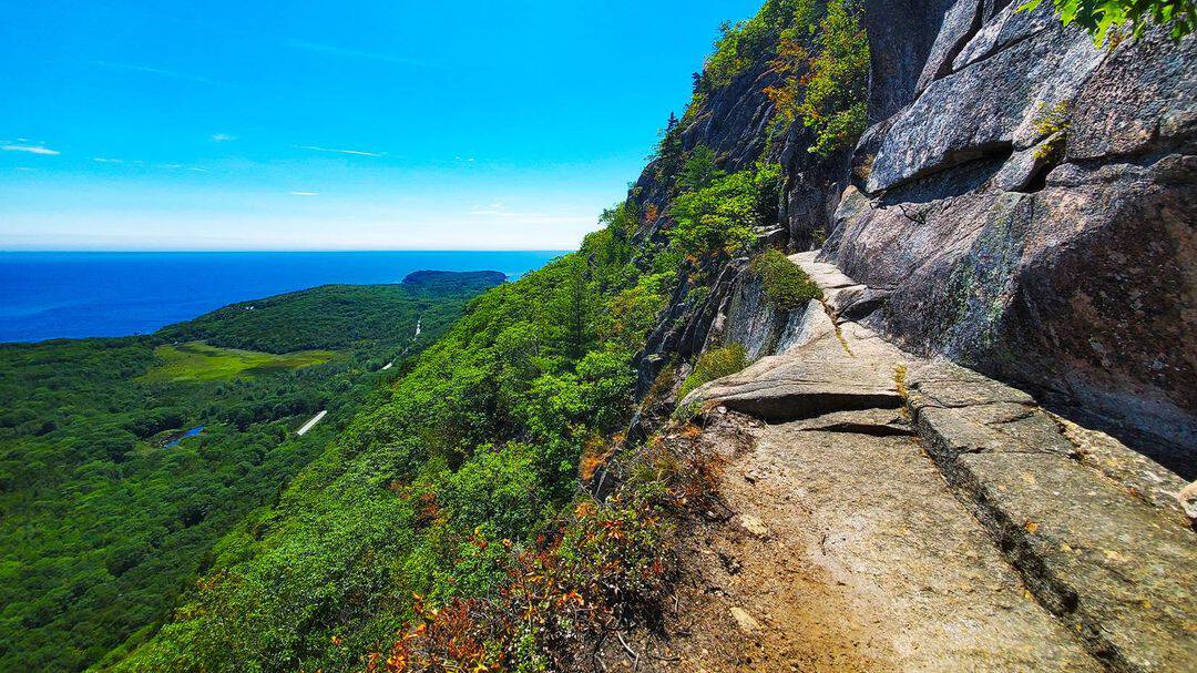
Rising more than 1,000 feet in under a mile up the sheer east face of Champlain Mountain, Acadia’s Precipice Trail uses dozens of iron rungs, ladders, and narrow catwalks bolted directly into open granite cliffs above Frenchman Bay.
Trail builder Rudolph Brunnow designed this entire route between 1912 and 1917, and much of the original 1920s ironwork still remains in place today. A critic at the time called Brunnow’s ladder trails “distasteful to experienced climbers,” a complaint history has thoroughly overruled.
The trail closes seasonally, typically from mid-March through mid-August, to protect nesting peregrine falcons along the cliffs. Descending isn’t recommended; most hikers loop back down via the gentler Champlain North Ridge Trail instead.
A so-called “intimidator obstacle” appears within the first few minutes of the climb, a boulder requiring two awkwardly placed iron rungs to clear. Hikers who struggle here are gently encouraged to turn back before things get considerably steeper and more exposed further up the cliff face.
Where: Park Loop Road, Bar Harbor, ME 04609
9. The Kalalau Trail, Hawaii
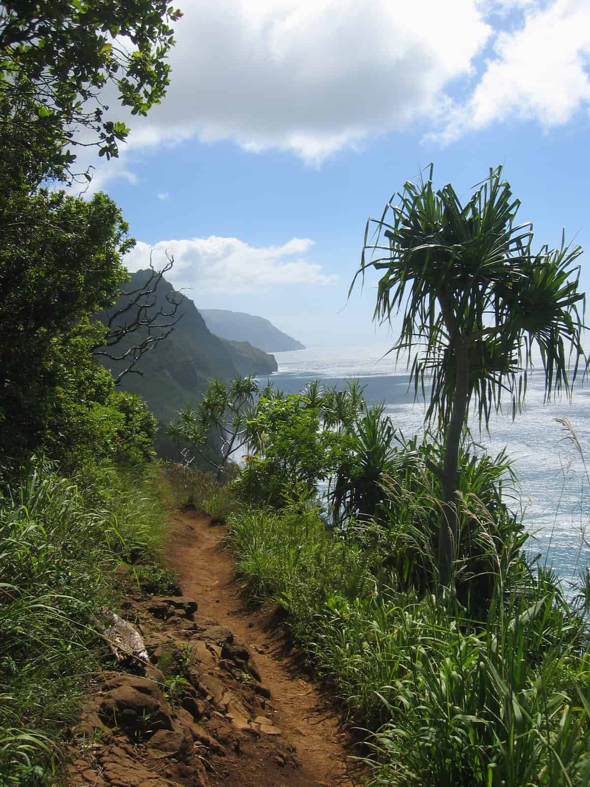
Kauai’s Kalalau Trail runs 11 miles one-way along the dramatic Nāpali Coast, threading through five separate valleys beneath sea cliffs that tower roughly 4,000 feet above the Pacific Ocean, passing several ancient Hawaiian archaeological sites scattered along the route.
Day hikers can reach Hanakapiʻai Beach at mile two without any special permit, simply a reservation to enter Hāʻena State Park itself. Continuing further, toward Hanakoa Valley and ultimately Kalalau Beach, requires a separate, highly competitive overnight camping permit.
The trail’s most notorious stretch, Crawler’s Ledge, demands steady nerves and careful footing along an exposed cliffside path. Permits are released exactly 90 days in advance and routinely disappear within minutes, making this one of the hardest-won bucket-list hikes in the country.
Composting toilets exist at the two designated camping areas, but no potable water is available anywhere along the route, so every drop from a stream needs filtering first. Winter hiking carries extra risk too, given frequent flash floods and swollen stream crossings that can strand hikers for hours.
Where: Kē’ē Beach, Hāʻena State Park, Hanalei, HI 96714
10. The Hoh River Trail, Washington
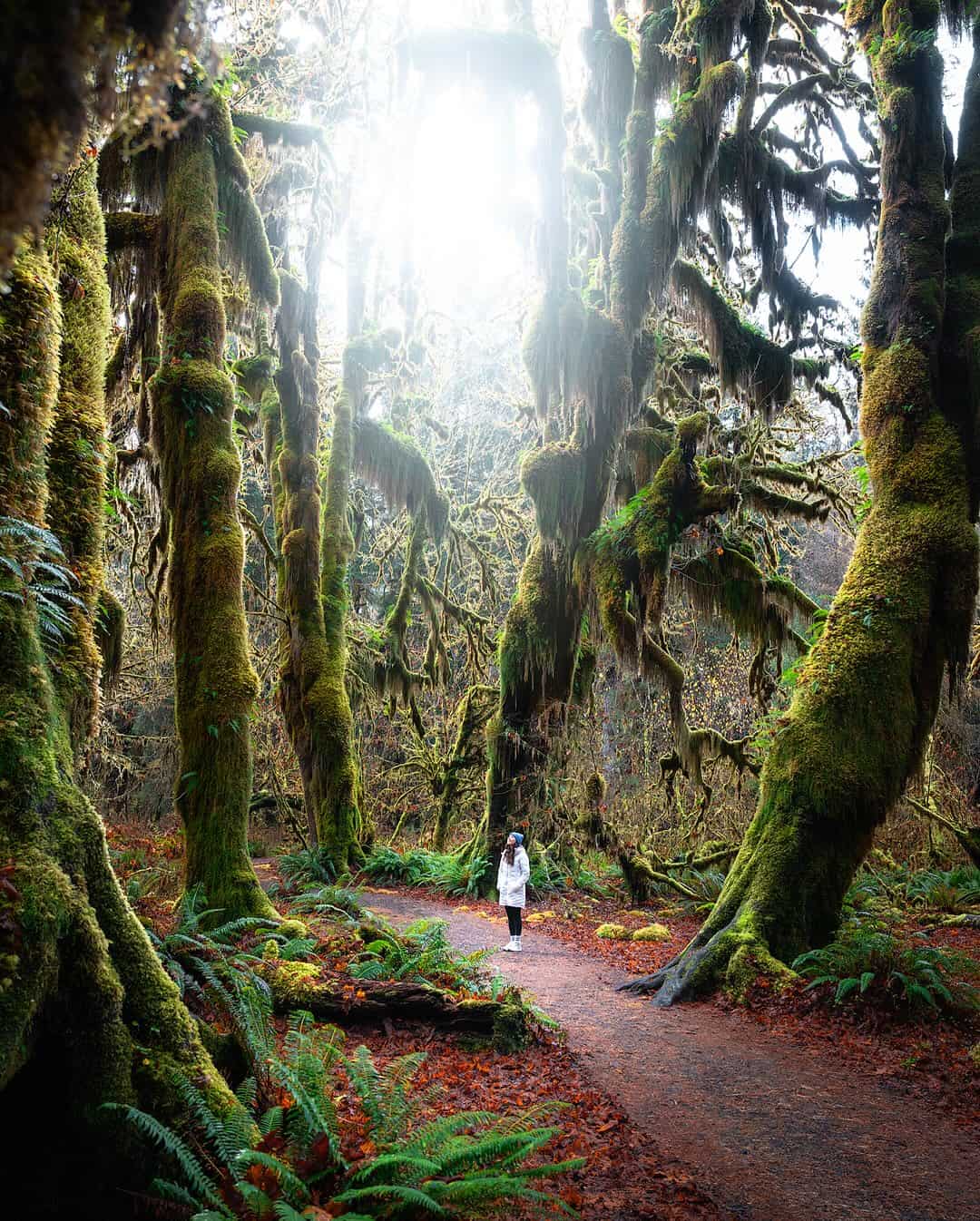
The Hoh River Trail begins at Olympic National Park’s Hoh Rain Forest Visitor Center and follows its namesake glacial river 17.3 miles through one of the wettest forests anywhere in the continental United States, soaking up roughly 140 inches of rain in an average year.
Sitka spruce and western hemlock trees here grow well past 300 feet tall, draped in thick club moss heavy enough to blur the line between tree and landscape entirely. Roosevelt elk, reintroduced specifically to this valley decades ago, still wander the misty undergrowth in herds.
Hike the full distance, and the rainforest eventually gives way to subalpine meadows, ending at Glacier Meadows beneath Mount Olympus’s Blue Glacier. Most visitors instead sample just the first few flat, achingly beautiful miles before turning back toward the car.
The valley itself takes its name from the Hoh people, whose ancestral homeland sits at the river’s mouth where it meets the Pacific Ocean. Olympic National Park created this protected stretch in 1938 specifically to safeguard the Roosevelt elk herds that still roam its damp, mossy understory.
Where: Hoh Rain Forest Visitor Center, 18113 Upper Hoh Rd, Forks, WA 98331
What Ten Trails Taught Me About Showing Up Anyway
None of these hikes is convenient. Half of them require entering a lottery and hoping. A few demand climbing actual ladders bolted into actual cliffs. One of them might leave you legally fined if you skip the paperwork.
And yet here they all are, drawing hikers back year after year, proof that genuine difficulty has never once been a deterrent for the people who care most about reaching a summit, a ridge, or a stretch of coastline this specific.
What strikes me most, researching trails I haven’t personally set foot on, is how often the obstacle became part of the story. The iron rungs at Acadia were once called “distasteful.” The Angels Landing chains exist precisely because the original route was simply too narrow.
Even the permit systems, frustrating as they sound, exist because too many people fell in love with the exact same half-mile of rock at the exact same time. That’s a strange kind of compliment, when you think about it, paid entirely by accident.
Maybe that’s the real throughline connecting a granite scramble in Virginia to a rainforest trail in Washington state. Difficulty was never really the opposite of beauty out here. More often, it turned out to be the price of admission, and apparently, a price hikers have always been willing to pay.
More stories


Share this story